Chula Vista, California
| Chula Vista | |||
|---|---|---|---|
| — City — | |||
|
|||
| Nickname(s): The City of Allure, The Star City, CV, Boringtown USA, Chula, | |||
 |
|||
 Chula Vista
|
|||
| Coordinates: | |||
| Country | |||
| State | |||
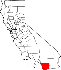
| County | San Diego | ||
| Government | |||
| - Type | Council-Manager | ||
| - City Council | Mayor Cheryl Cox Rudy Ramirez John McCann Pamela Bensoussan Steve Castaneda |
||
| - City Manager | Jim Sandoval | ||
| Area | |||
| - City | 51.2 sq mi (132.7 km2) | ||
| - Land | 48.9 sq mi (126.6 km2) | ||
| - Water | 2.4 sq mi (6.1 km2) | ||
| Elevation | 69 ft (21 m) | ||
| Population (2005)[1] | |||
| - City | 210,000 | ||
| - Density | 3,550.6/sq mi (1,370.9/km2) | ||
| - Metro | San Diego-Tijuana: 4,922,723 | ||
| Time zone | PST (UTC-8) | ||
| - Summer (DST) | PDT (UTC-7) | ||
| ZIP codes | 91909, 91910, 91911, 91912, 91913, 91914, 91915, 91921 | ||
| Area code(s) | 619 | ||
| FIPS code | 06-13392 | ||
| GNIS feature ID | 1660481 | ||
| Website | http://www.chulavistaca.gov/ | ||
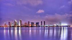
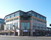
Chula Vista (pronounced /ˌtʃuːlə ˈvɪstə/; Spanish: beautiful view, due to its scenic location between the San Diego Bay and coastal mountain foothills) is the second largest city in the San Diego metropolitan area as well as the 7th largest city in Southern California. The city is found in the South Bay region of the metropolitan area in the U.S. State of California. Located just 7 miles (11 km) from downtown San Diego and 7 miles (11 km) from the Mexican border, the city is at the center of one of the richest economic and culturally diverse zones in the United States: The California-Mexico Border Region. Based on California Department of Finance estimates for January 1, 2007, the city's population was 227,723.
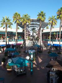
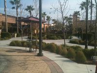
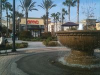
Founded in the early 1800s, Chula Vista is growing at a fast pace. As the second largest city in San Diego County, Chula Vista has quickly become a destination popular to many tourists. Located in the city is one of Americas few year-round United States Olympic Training centers. Popular tourist destinations include Cricket Wireless Amphitheater, Knott's Soak City USA, the Chula Vista marina, the Chula Vista Nature Center as well as golf courses and the region’s newest lifestyle center.
Contents |
History
Prehistory
The natural history of the area known as Chula Vista can be traced back millions of years through prehistoric fossils of both land and sea types. Archaeological evidence shows at least 10,000 years of human habitation in the region. Around 3000 B.C., Yuman-speaking people began moving into the area. Many of the Native American Indians in San Diego today are descendants of the Kumeyaay tribe who roamed here for thousands of years.
New Spain & Alta California
In 1542, a fleet of three small ships sailed into San Diego Harbor commanded by Juan Rodríguez Cabrillo. In 1795, Chula Vista area became a part of a Spanish grazing lands for their cattle and horses known as Rancho del Rey or "The King's Ranch." The name was changed by the Mexico government to Rancho de la Nación or National Ranch. The ranch encompassed the area now known as National City, Chula Vista, Bonita, Sunnyside and the Sweetwater Valley. In 1845, Rancho de la Nación was granted to John (Don Juan) Forster, the brother-in-law of Mexican governor Pio Pico.
19th century America
The United States claimed California following the Mexican-American War in 1847. Even though California became a state in 1850, land grants were allowed to continue as private property under American law. Forster continued to operate the ranch for ten years until he sold it to François Louis Alfred Pioche (1818–1872), a San Francisco financier. The land was then again sold to the Kimball brothers in 1868. Frank, Warren and Levi Kimball intended to develop the land into productive American-style cities and farms. Frank Kimball is also responsible for bringing the Santa Fe Railroad to San Diego, with its first terminus in National City.
Several directors of the Santa Fe Railroad and Colonel W.G. Dickerson, a professional town planner, formed the San Diego Land and Town Company. Colonel W.G. Dickerson is regard as the founder of Chula Vista and National City, his house in National City is still intact and perserved. The company set out to develop lands of the National Ranch for new settlers. They issued promotional material to attract settlers that read: "Upon the best part of this tract, 5,000 acres (20 km²) are being subdivided into five acre (20,000 m²) lots with avenues and streets 80 feet in width running each way, the steam motor road passing though the center. This tract, known as Chula Vista, lies but a mile from the thriving place of National City." With this announcement, the boom of the 1880s was on.
These five-acre (20,000 m²) lots sold for $300 per acre ($740 per hectare) in 1887. The purchaser was required to build a home within six months on the parcel. By 1889, ten houses were under construction and land sales were excellent. Thus, the town of Chula Vista was created. A resident, James D. Schulyer, suggested the name Chula Vista for the town and the San Diego Land and Town Company adopted it. Chula Vista can be roughly translated in Spanish as "beautiful view."
In 1888, the Sweetwater Dam was completed to bring water to Chula Vista residents and their farming lands. Frank Kimball became the State Commissioner of Agriculture and discovered citrus trees to be the most successful crop for the area. Chula Vista eventually became the largest lemon-growing center in the world for a period of time.
A railroad was built to connect San Diego, National City, Chula Vista and Otay. This railroad, known as the National City and Otay Railroad, flourished for many years.
20th century
On October 17, 1911, an election was held in Chula Vista to incorporate and the people voted in its favor. The State of California approved this Act of Incorporation in November. The Board of Trustees of Chula Vista held an election at the office of the People's State Bank and E.T. Smith was elected President.
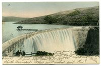
Local farmers continued to grow lemons as their primary crop and used over eight packing houses in the city. However, terrible weather came to the area in the following years causing severe damage. Crops suffered from a severe freeze in 1913 and droughts in 1914 and 1915. The Floods of 1916 caused major damage with a break in the Lower Otay Dam causing millions of gallons (or liters) of water to empty out in two and a half hours. Railroad tracks near Second Avenue were swept away, 23 homes were destroyed and more than 20 people were killed.
In February 1916, the Hercules Powder Company began the design and construction of a kelp processing plant covering a 30-acre (12 hectare) plot of land in Chula Vista. Kelp was an ideal source of materials used in the production of explosives. The plant produced potash and acetone to make cordite, a smokeless powder used extensively by the British armed forces in World War I. Hercules produced 46,000,000 lb (21,000,000 kg) of cordite for the British government during the war, making it the largest kelp harvesting fleet in the world at the time. The plant was located on what is now known as Gunpowder Point, currently the home of the Chula Vista Nature Center.
Although the Great Depression affected Chula Vista significantly, agriculture still provided considerable income for the residents. In 1931, the lemon orchards produced $1 million in revenue and the celery fields contributed $600,000. World War II ushered in changes that would affect the City of Chula Vista forever. The principal reason was the relocation of Rohr Aircraft Corporation to Chula Vista in early 1941, just months before the attack on Pearl Harbor. Rohr employed 9,000 workers in the area at the height of its wartime production. With the demand for housing, the land never returned to being orchard groves again. Chula Vista's two sites for wartime housing are where The Chula Vista Shopping Center and Hilltop Middle School, and a fire station now stand. The population of post-World War II Chula Vista tripled from 5,000 residents in 1940 to more than 16,000 in 1950.
Post World War II
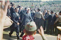
After the war, many of the factory workers and thousands of servicemen stayed in the area resulting in the huge growth in population. During those years, numerous schools, homes, banks, restaurants, gas stations and shopping centers opened to accommodate the growing number of residents. The last of the citrus groves and produce fields disappeared as Chula Vista became one of the largest communities in San Diego. President Eisenhower visited the Country club in Chula Vista to play golf. He is the only President to visit Chula Vista.
Modern Chula Vista
Over the next few decades, Chula Vista continued to expand eastward. Plans called for a variety of housing developments such as Eastlake, Rancho del Rey and Otay Ranch neighborhoods. In 2003, Chula Vista had 200,000 residents and was the second largest city in San Diego County. As the city continues to grow, it strives for a balance of attractive neighborhoods and strong business base but holds fast to maintaining a sense of community and small town values upon which it was founded.
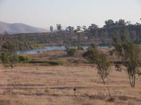
Chula Vista is growing at a fast pace, with major developments taking place in the Otay Valley near the U.S. Olympic Training Center and Otay Lake Reservoir. Thousands of new homes have been built in the Otay Ranch, Lomas Verdes, Rancho Del Rey, Eastlake and Otay Mesa Areas. The South Bay Expressway, a toll-road extension of state route 125, opened November 19, 2007, will connect freeways 805 and 905 with State Route 54, officially connecting the areas closest to the border to areas of East County, as well as creating a link to Interstates 8 and SR 94.
On May 30, 2006 officials from Chula Vista and the San Diego Chargers met to potentially discuss building a new stadium that would serve as the home for the team. Yet, in June 2009 the Chargers removed Chula Vista as a possible location for a new stadium.[2]
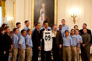
The San Diego Regional Airport Board studied the feasibility of bringing commercial operations from San Diego's Lindbergh Field to Otay Mesa's Brown Field. However, plans were ruled out when the mountains proved to be a potential hazard for full-scale commercial air traffic. Also, it was decided that the airport's proximity to Mexico might have diplomatic repercussions. However, a cargo port was considered, as well as a bi-national airport with Tijuana's airport. President Barack Obama signed the plan approving of a bridge to Tijuana airport.
In 2009, Chula Vista was ranked as one of the most boring cities in America by Forbes Magazine.[3]
Chula Vista is in discussions to bring a university to the city. A UC or Cal State has been talked of but private universities are in the talks too. Plans of a university are halted till they can acquire land.
Chula Vista is in progress to develop the bay front. There have been talks for a 2,000 room hotel to be built on the bay front.
Chula Vista's Centennial is next year in 2011. Plans have been made to have a book written about Chula Vista's history.
Zones and Developments
With the rapid population growth sense the 1980s Chula Vista has been a city divided by the 805 freeway.Areas and zones west of the 805 are locally known as "Westside Chula Vista" and east of the freeway "Eastside Chula Vista".The Eastside of the city contains multiple housing developments while the Westside boasts older zones
Zones West of the 805
- Northwest
- West
- Southwest
- North Central
- Downtown CV
- Middle South
- South Central
- South
- Otay
- East
- Middle East
Developments/Areas East of the 805
- Sweetwater Canyon
- Terra Nova
- Telegraph Canyon
- Far East
- Sunbow
- Rancho Del Rey
- Otay Ranch
- Bonita Canyon
- College Estates
- Eastlake
- San Miguel Ranch
- Rolling Hills Ranch
Climate
| Climate data for Chula Vista, California | |||||||||||||
|---|---|---|---|---|---|---|---|---|---|---|---|---|---|
| Month | Jan | Feb | Mar | Apr | May | Jun | Jul | Aug | Sep | Oct | Nov | Dec | Year |
| Average high °F (°C) | 69 (20.6) |
68 (20) |
68 (20) |
68 (20) |
70 (21.1) |
73 (22.8) |
76 (24.4) |
78 (25.6) |
78 (25.6) |
76 (24.4) |
72 (22.2) |
69 (20.6) |
72.4 (22.44) |
| Average low °F (°C) | 46 (7.8) |
48 (8.9) |
50 (10) |
53 (11.7) |
57 (13.9) |
60 (15.6) |
64 (17.8) |
65 (18.3) |
64 (17.8) |
58 (14.4) |
50 (10) |
46 (7.8) |
55 (12.8) |
| Precipitation inches (mm) | 2.01 (51.1) |
2.01 (51.1) |
2.09 (53.1) |
0.71 (18) |
0.16 (4.1) |
0.08 (2) |
0.04 (1) |
0.08 (2) |
0.02 (0.5) |
0.39 (9.9) |
1.1 (28) |
1.18 (30) |
10.0 (254) |
| Source: U.S. Climate Data[4] | |||||||||||||
Economy
According to the City's 2008 Comprehensive Annual Financial Report,[5] the top employers in the city are:
| # | Employer | # of Employees |
|---|---|---|
| 1 | Sweetwater Union High School District | 4,598 |
| 2 | Chula Vista Elementary School District | 2,669 |
| 3 | Southwestern Community College | 2,100 |
| 4 | Rohr Inc/Goodrich Aerospace | 1,903 |
| 5 | City of Chula Vista | 1,481 |
| 6 | Sharp Chula Vista Medical Center | 1,410 |
| 7 | Scripps Mercy Hospital Chula Vista | 1,032 |
| 8 | Wal-Mart | 950 |
| 9 | United Parcel Service | 656 |
| 10 | Costco Wholesale Corp. | 623 |
Culture
Chula Vista is home to OnStage Playhouse the only live theater in South Bay, San Diego.
In 1973, a group called Rose & The Arrangement, performed a novelty hit titled "Chula Vista," which tells of a "magic twanger" which was bought by a "magic gypsy" by way of "La Jolla, San Diego, and on to Harbor Drive, to Highway 5," and on to Chula Vista. It first appeared on KGB-FM's collaboration album Homegrown I, which was recorded and sold for charity; and featured only local San Diego artists. It was played many times on "The Dr. Demento Show" as well as being heard all around San Diego County on a local San Diego radio show "Hudson and Bauer" (featuring Mack Hudson & Joe Bauer) on KFMB 760am radio during the 1970s.
Other points of interest and events include the Chula Vista Nature Center[6], the J Street Harbor[7], the Third Avenue Village[8], the Olympic Training Center[9], and Knott's Soak City. Downtown Chula Vista hosts a number of cultural events, including the famous Lemon Festival, Starlight Parade, and Chula Vista Rose Festival.
Notable natives and residents
Demographics
According to the 2000 census, there were 173,556 people, 57,705 households, and 43,567 families residing in the city. The population density was 1,370.9/km² (3,550.9/mi²). There were 59,495 housing units at an average density of 469.9/km² (1,217.2/mi²). The racial makeup of the city was 55.10% White, 4.62% African American, 0.78% Native American, 10.98% Asian, 0.58% Pacific Islander, 22.13% from other races, and 5.85% from two or more races. Hispanic or Latino of any race were 49.59% of the population.
There were 57,705 households out of which 40.7% had children under the age of 18 living with them, 55.7% were married couples living together, 14.9% had a female householder with no husband present, and 24.5% were non-families. 19.5% of all households were made up of individuals and 7.9% had someone living alone who was 65 years of age or older. The average household size was 2.99 and the average family size was 3.44.
In the city the population was spread out with 28.7% under the age of 18, 9.4% from 18 to 24, 31.6% from 25 to 44, 19.3% from 45 to 64, and 11.0% who were 65 years of age or older. The median age was 33 years. For every 100 females there were 94.3 males. For every 100 females age 18 and over, there were 90.4 males.
The median income for a household in the city was $44,861, and the median income for a family was $50,136. Males had a median income of $36,812 versus $28,430 for females. The per capita income for the city was $18,556. About 8.6% of families and 10.6% of the population were below the poverty line, including 13.0% of those under age 18 and 9.2% of those age 65 or over.
Current estimates
According to estimates by the San Diego Association of Governments, the median household income of Chula Vista in 2005 was $64,110 (not adjusted for inflation). When adjusted for inflation (1999 dollars; comparable to Census data above), the median household income was $52,084.
According to recent estimate, the population was 227,723, making it the second-largest city in San Diego County, the 14th-largest in the state of California, and 89th-largest in the United States.[10]
Transportation
Local area freeways
Local area freeways in within the city of Chula Vista include
.svg.png) Interstate 5
Interstate 5.svg.png) Interstate 805
Interstate 805 State Route 54
 State Route 125
Arterial streets
Most streets west of the 805 freeway are laid out on an offset grid formation with streets running North,South,East,and West.Streets north of "C" Street have the prefix "North"(e.g.:North Fourth,North Second etc.)Streets east of Hilltop have a prefix of "East"(e.g.:East Palomar,East Orange etc.).Though "West" and "South" prefixes are not addressed,they are sometimes used in local dialect."South" prefixes apply to streets south of Palomar while "West" is applied to streets west of 5th Avenue.
East-West arterials
- "C" Street
- "E" Street-Bonita Rd(East of Flower Street)
- "H/East H Street(East of Hilltop)-Proctor Vly Road(East of Mount Miguel)
- "J/East J Street(East of Hilltop)
- "L"/East L Street(East of Hilltop)-Telegraph Cyn Rd-Otay Lakes Rd
- Naples/E.Naples(East of Hilltop)
- Palomar/E. Palomar(East of Hilltop)
- Orange/E. Orange(East of Hilltop)-Olympic(East of 805 Freeway)
- Main/Auto Park Way(East of 805 Freeway)
North-South arterials
- Broadway(Also known as "South Bay Strip")
- Fourth/N. Fourth Ave(North of "C" Street)
- Third
- Hilltop
- Crest-Oleander(South of T.C. Road)
- Medical Center Dr-Brandywine(South of E.Palomar)
- Paseo Del Rey
- Paseo Ranchero-Heritage(South of T.C. Road)
- Otay Lakes/La Media(South of T.C. Road)
- Eastlake Dr-Eastlake Pkwy(At Miller)
- Hunte Pkwy
Public Transport
As of 2010 there is an estimated 505,500 people living in the South Bay Megaregion of San Diego County.Public transport options in the City of Chula Vista include ![]() San Diego Trolley
San Diego Trolley
- Bayfront E Street Station
- H Station
- Palomar Station
MTS buses
- 701=H Station-Palomar Station:Via H,Hilltop,and Palomar
- 703=H Station-Town Center Mall(Sundays Only)
- 704=Bayfront,E Station-Palomar Station:Via E Street,Fourth,East Naples,and Medical Center
- 705=Bayfront,E Station-Plaza Bonita&SWC:Via E Street,Bonita Rd, and Otay Lakes
- 707=SWC-Town Center Mall:Via East H & Eastlake Parkway
- 708=E Street Trolley-Nature Center
- 709=H Station-Town Center Mall:Via H/East H,Otay Lakes,East Palomar
- 712=Palomar Station-SWC:Via Palomar/East Palomar,La Media/Otay Lakes
- 932=Iris Ave Station-8th St Ntl City:Via South Bay Strip,E and F Streets
- 929=Iris Ave Station-Downtown SD:Via Third,Fourth,and E Street
- Denotes CV Transit Routs
- Denotes San Diego MTS routes
Government
Local government
According to the city’s most recent Comprehensive Annual Financial Report, the city’s various funds had $322.9 million in Revenues, $287.5 million in expenditures, $1,232.7 million in total assets, $258.6 million in total liabilities, and $181.0 million in cash and investments.[5]
Presently the City Council is led by Mayor Cheryl Cox. It has four other city councilmembers: Rudy Ramirez, John McCann, Pamela Bensoussan, Steve Castaneda.[11] Due to Councilmember McCann having been activated by the USNR, his seat is temporarily filled by Mitch Thompson, who was appointed by the City Council in October 2009.[2] Councilmember McCann returned from Navy in 2010 he has took his seat back and Councilmember Thompson has left office for McCann's return.
The structure of the management and coordination of city services is:[5]
| City Department | Director |
|---|---|
| City Manager | Jim Sandoval |
| Assistant City Manager | Scott Tulloch |
| City Attorney | Bart Miesfield |
| City Clerk | Donna Norris |
| Chief of Police | David Bejarano |
| Director of Budget & Analysis | Edward Van Eenoo |
| Director of Conservation | Michael Meacham |
| Director of Finance/Treasurer | Maria Kachadoorian |
| Fire Chief | Dave Hanneman |
| Director of General Services | Jack Griffin |
| Director of Human Resources | Marcia Raskin |
| Director of Library | Leah Browder |
| Director of Information Technology Services. | Louie Vignapiano |
| Director of Nature Center | Daniel D. Beintema |
| Director of Planning & Building | Gary Halpert |
| Director of Public Works | Dave Byers |
| Director of Recreation | Buck Martin |
| Director of Redevelopment and Housing | Eric Crockett |
Politics
In the state legislature Chula Vista is located in the 40th Senate District, represented by Democrat Denise Moreno Ducheny, and in the 78th and 79th Assembly District, represented by Democrats Martin Block and Mary Salas respectively. Federally, Chula Vista is located in California's 51st congressional district, which has a Cook PVI of D +7[12] and is represented by Democrat Bob Filner. Out of the city's total population, 103,985 are registered to vote. The three largest registered parties in the city are the Democratic Party with 44,598, Republican Party with 32,124, and Decline to State with 23,702.[13]
Education

The Sweetwater Union High School District, headquartered in Chula Vista, serves Chula Vista.[14]
Chula Vista is also home to 1 of the 4 Private high schools in San Diego County. Chula Vista also has a Junior college named Southwestern College (California).
Sister cities
Chula Vista has 3 sister cities, as designated by Sister Cities International.
 Cebu City, Philippines
 Odawara, Japan
 Tijuana, Mexico
Chula Vista has an International Friendship Commission which works with the sister cities. In City Hall there is the Flags of Japan and the Philippines inside the lobby.
References
- ↑ World Gazetteer – San Diego-Tijuana
- ↑ 2.0 2.1 "Chula Vista Out As Possible Chargers Stadium Site". 10News.com (Internet Broadcasting Systems, Inc.). 24 June 2009. http://www.10news.com/news/19849294/detail.html. Retrieved 13 August 2009.
- ↑ "America's Most Boring Cities". Forbes. http://www.forbes.com/media/2008/12/10/media-newspapers-news-biz-media-cx_jz_1210boringcities_slide.html?partner=canoe. Retrieved 2009-01-05.
- ↑ "Monthly averages for Chula Vista, California". http://www.usclimatedata.com/climate.php?location=USCA0219. Retrieved Feb 28 2009.
- ↑ 5.0 5.1 5.2 City of Chula Vista CAFR Retrieved 2009-08-07
- ↑ "Nature Center". Community Services. City of Chula Vista. http://www.chulavistaca.gov/City_Services/Community_Services/Nature_Center/default.asp. Retrieved 9 November 2009.
- ↑ "Chula Vista Launch Ramp". SD Boating.com. http://www.sdboating.com/chulav.htm. Retrieved 9 November 2009.
- ↑ "Third Avenue Village". Third Avenue Village Association. http://www.thirdavenuevillage.com/. Retrieved 7 November 2009.
- ↑ "Chula Vista Olympic Training Ctr". United States Olympic Committee. http://www.teamusa.org/pages/1375. Retrieved 9 November 2009.
- ↑ State of California, Department of Finance. "January, 2007 Cities and Counties Ranked by Size, Numeric and Percent Change", Sacramento, California, May 2007. Retrieved May 2, 2007.
- ↑ "Chula Vista City Government". City of Chula Vista. http://www.chulavistaca.gov/city_Services/Mayor_Council/Default.asp. Retrieved 13 August 2009.
- ↑ "Will Gerrymandered Districts Stem the Wave of Voter Unrest?". Campaign Legal Center Blog. http://www.clcblog.org/blog_item-85.html. Retrieved 2008-02-10.
- ↑ "Report of Registration - State Reporting Districts". San Diego County Registrar of Voters. 2009-03-22. http://www.sdcounty.ca.gov/voters/Eng/reports/current_reg_report.pdf. Retrieved 2009-04-19.
- ↑ "Home." Sweetwater Union High School District. Retrieved on March 30, 2010.
External links
- Chula Vista Public Library website
- Official City of Chula Vista website
- Chula Vista Schools Location and Phone Directory
|
|||||||||||||||||||||||||||||||||||||||||||||||||||||||||||||||||||||||||||||||||||||||||||||